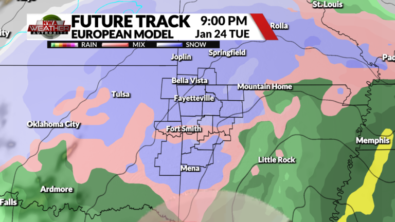
Winter weather impacts are looking more likely as we head into next Tuesday across Northwest Arkansas and the River Valley, though uncertainty still remains. The track and timing of the associated low pressure will determine how impactful the storm system will be, with latest forecast trends coming into better agreement about how things will evolve.
In order to get significant winter weather in NWA, the track of the low pressure needs to ride along the Red River before ejecting to the northeast, allowing for the heaviest snow bands to reach the area. Most of the recent model runs show this happening, but temperatures will be mostly above freezing as we go throughout Tuesday. Dynamic cooling of the atmosphere and surface during the day will allow for rain to eventually change over to a winter mix of freezing drizzle, sleet and snow, before becoming all snow around sunset in Northwest Arkansas. We do not currently expect this system to be as impactful in the River Valley, but a slight southern shift in the expected track would lead to greater chances for snowfall.
As we always say this far out, things can and will change! Expect the models to continue to change as go throughout the weekend, with snowfall amounts being fine tuned. Regardless of what happens on Tuesday, this system is very powerful and has the potential to cause significant winter weather impacts, so stay tuned with your Weather Authority Team for the latest information!


