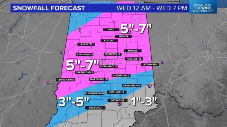
Tuesday will be dry but heavy snow arrives early Wednesday morning.
INDIANAPOLIS — Most of central Indiana is under a winter storm watch from late Tuesday night through Wednesday afternoon.
Snowfall potential is 5-7 inches for the central part of the state. Totals will be lower south and a bit higher north. This storm is still out west and there will be some adjustments to snowfall potential as it gets closer.
Expect dry weather tonight and most of Tuesday. Forecast highs are near 40 degrees. The winter storm arrives later Tuesday night and precipitation will start as rain before changing over to snow. Some of that snow will be heavy at times Wednesday morning. This means a slow and snowy Wednesday morning drive.
It is a good idea to prepare now for tricky travel and school and business closings on Wednesday. The heavy snow will end by early afternoon.
There are a few things working in our favor with this storm system. Temperatures will be around 32 degrees and this will help melt some of the snow and lead to lower snow depth. This snow will be easier to move, too, with temperatures near freezing.
Travel should start to improve later in the day Wednesday. Stay tuned for updates.
The weather pattern stays active this week with a few snow showers on Thursday, a wintry mix possible later Friday and another round of rain and snow on Sunday.


