When you look at the big picture of things…for the next couple of weeks or so…one is struck by the likelihood of milder to warmer than average temperatures. There just isn’t any real sustained cold weather entering the pattern here in the Plains. There will be a few shots of cooler air…perhaps next weekend…maybe. Overall though…the 1st half of the new month ahead looks mild.
We’re likely going to be in the 60s through the weekend…and then 70s starting next week. I don’t think we’ll get to 80° but it may get close especially with increased winds playing a role in stirring up the atmosphere. At this point no record highs are expected BUT there may be a chance of seeing some record warm lows later next week.
+++++++++++++++++++++++++++++++++++++++++++++++
Forecast:
Today: Mostly sunny and mild with highs mid to upper 60s
Tonight: Fair and cool with lows near 40°
Tomorrow: Partly cloudy and nice with highs in the mid 60s
Sunday: Mostly cloudy with a small chance of a sprinkle but perhaps a shower or two towards the Lakes region. Highs in the low to mid 60s
Halloween: Looks great with highs in the 70° range
+++++++++++++++++++++++++++++++++++++++++++++++
Discussion:
While there is some weather to talk about…locally…it doesn’t look all that impressive for us in terms of changing the day to day forecast.
There is an upper level wave that should drop far enough to the south and southeast of KC this weekend to only spin up some clouds from the south. These clouds will move towards the region tomorrow. This is connected to the upper level storm that is in Texas today…that system will be tracking up into eastern MO over the weekend.

You can clearly see the core of the system in the western part of Texas.
This will spin up towards St Louis later in the weekend…then eventually another piece of energy will move through the Plains on Sunday night into Monday morning, but aside from some clouds…that’s about the only real affect on our weather that I’m expecting. There is a small chance of a few sprinkles or showers…mainly SE of the Metro early on Sunday but the better chances may be closer to the Lakes region.
Beyond this…the main story for next week will the the warmth building back in. As we’ve talked about on the air for the last few days the pattern overall is a warm one. Next week with stronger south and southwest winds developing…it will get even warmer I think. Take a look at the latest 6-10 day forecast probabilities. A lot of red from the Plains eastwards.

Winds will be increasing as well…especially starting next Wednesday and we’ll likely have several days of strong winds again. Surface moisture will also be coming up from the Gulf region later in the week as well.
Record highs for the 1st week of November are mostly in the 80s

Those lofty numbers may be tough to achieve, but with the increased dew points later in the week and the stronger wind potential…record warm low temperatures may be on the table…especially Thursday and Friday. The record warm low is 61° set in 1964 for Thursday the 3rd. Then on Friday the 4th the record warm low is 58° in 1916 and 1895.
We’ll see how that shapes up. There may be a front towards the end of the week (Friday) that could mess up the potential of that record warm low on Friday…because it may get cooler Friday afternoon or night behind the front.
Likely whatever quick hitting shot of chilly air moves through will be fleeting.
Overall mild for the 1st 2 weeks of November with perhaps a day or two of chilly air every so often. The front possible later in the week may be a decent rain producer…that will be needed, especially with the increased winds expected again.
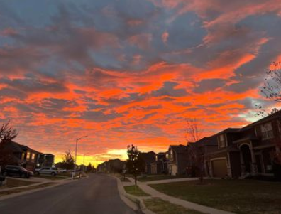
TJ Winkelmann has the feature photo of the day.

Have a great weekend.
Joe


