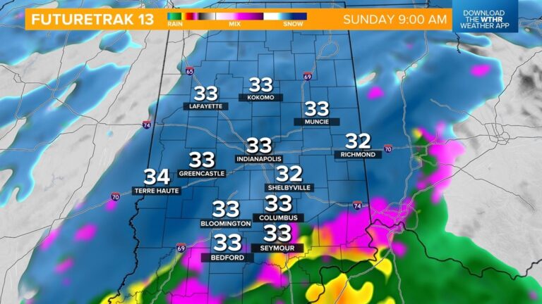
Sunday’s event will start with a brief wintry mix after 2 a.m. before turning to all snow by Sunrise.
INDIANAPOLIS — Saturday should be a fairly typical January day with temperatures topping out in the mid-to-upper 30s. Skies remain mostly cloudy throughout central Indiana but the southern tier of the state could see a little sunshine in the afternoon.
Temperatures hold steady near the freezing mark overnight as our next storm system moves in. This will start as a brief wintry mix after 2 a.m. before turning to all snow by Sunrise Sunday.
Travel will become tricky during the first part of the day as scattered snow showers will be likely through midday. Most of the precipitation exits the state in the afternoon as temperatures rise to the mid-30s. Any lingering moisture will be light drizzle or a few flurries during the second half of the day.
Snowfall potential will be highest on the eastern side of the state where a few bands of snow will be most likely. Look for 1-3″ in this zone with the Indianapolis metro area seeing up to 2″ and even lighter snow potential in west central Indiana.
We should see a couple more quiet days to start next week with mostly cloudy skies Monday and highs in the upper 30s then reaching the low 40s Tuesday afternoon.
We’re watching for another potentially potent system to arrive Tuesday night into Wednesday with a wintry mix changing to accumulating snow. Stay tuned for updates on the mid-week system.


